
Satellite Precision

Mobile App Features
Digital Policy Enrollment
Quick paperless enrollment
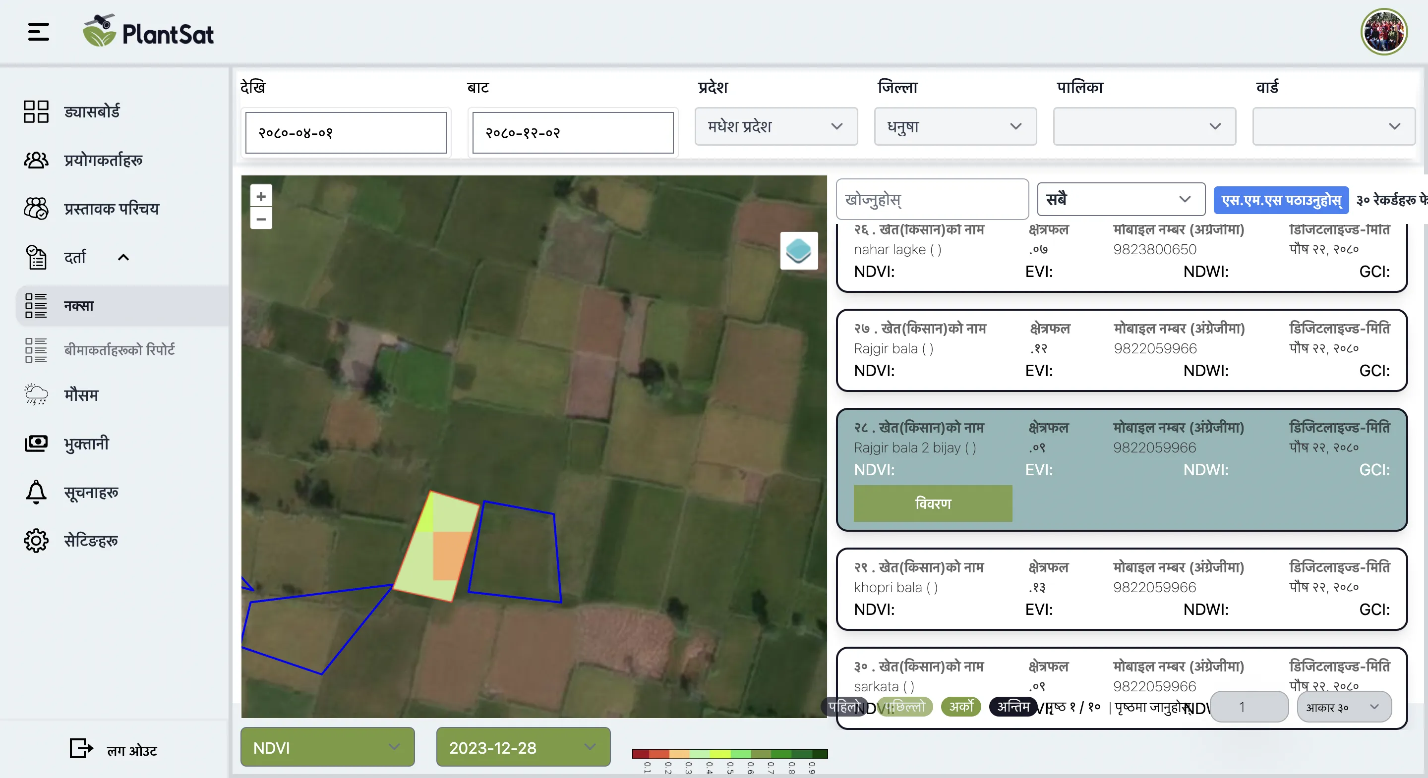
Farm Polygon Mapping
GPS boundary mapping
Farm Photos & Videos
Visual documentation
Digital Claim Validation
Satellite assessment
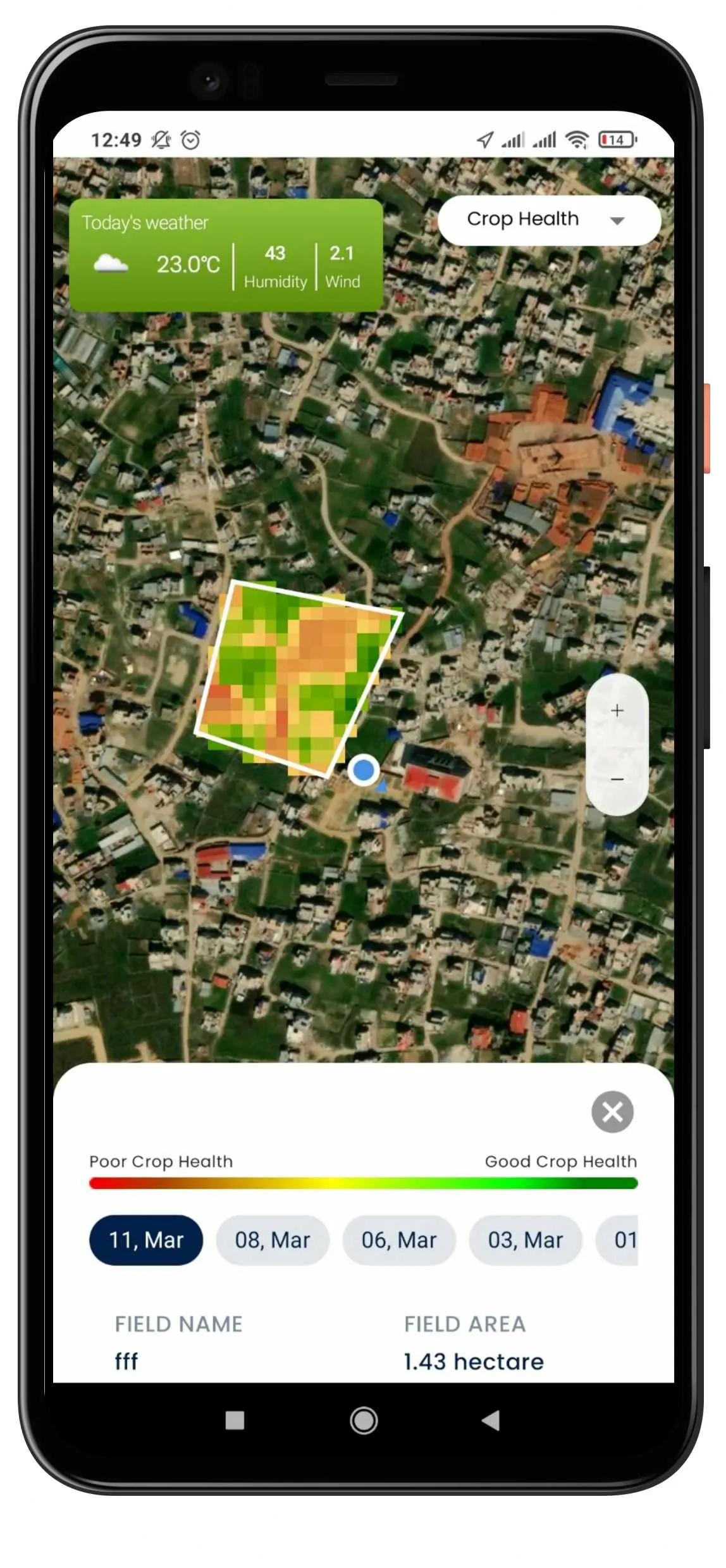
Vegetation Indices
NDVI, EVI, NDWI, MSAVI
Expert Consultation
Access to experts
Web Portal Feature
Remote Monitoring
Satellite-based digital field surveillance
Claim Processing
Comprehensive validation features
KYC Verification
Secure document verification
Success Stories
Read the latest from our projects
Insured Farmer's Experience
Chitra Bahadur Chaudhary used PlantSat Digital Insurance to protect his crops from drought, heavy rainfall, and pest infestation.
Rice Farmer's Journey
Ramesh Tiwari has spent years cultivating his rice plantation and knows the risks that come with farming.
First-Time Insurance
Bina Pandey from Satpatti took a bold step and insured her rice plantation for the first time.